The Aerodynamics of the V-bombers – Part 3
Dr Steve Liddle CEng FRAeS, is a Vulcan to the Sky Trustee and Principal Aerodynamicist at Aston Martin Formula One Team. The articles here are
The following article was recently published by James Blatch in his email newsletter. James is author of the novel, The Final Flight. His father, John R Blatch AFC, was an RAF test pilot throughout the 1960s, having flown fighters in the middle east before that point.
The Final Flight is set at a secretive Royal Air Force station in the 1960s. The situation (not the story) is loosely based on my own father, who was an RAF test pilot at Boscombe Down from 1960-1966.
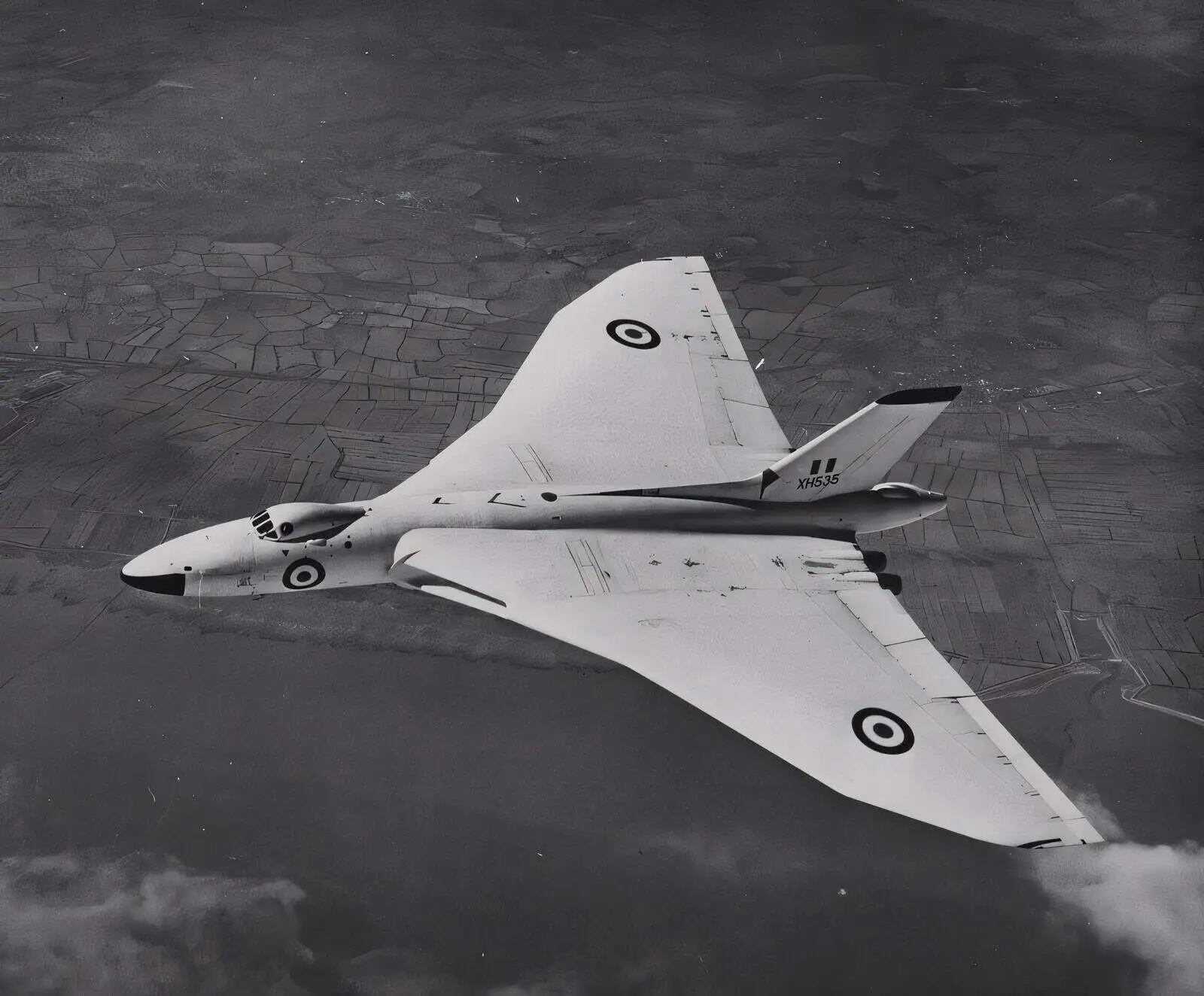
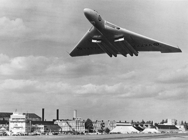
We don’t have many photographs from that era (long before everyone carried a high resolution camera in their back pocket!). However, we do have this one:

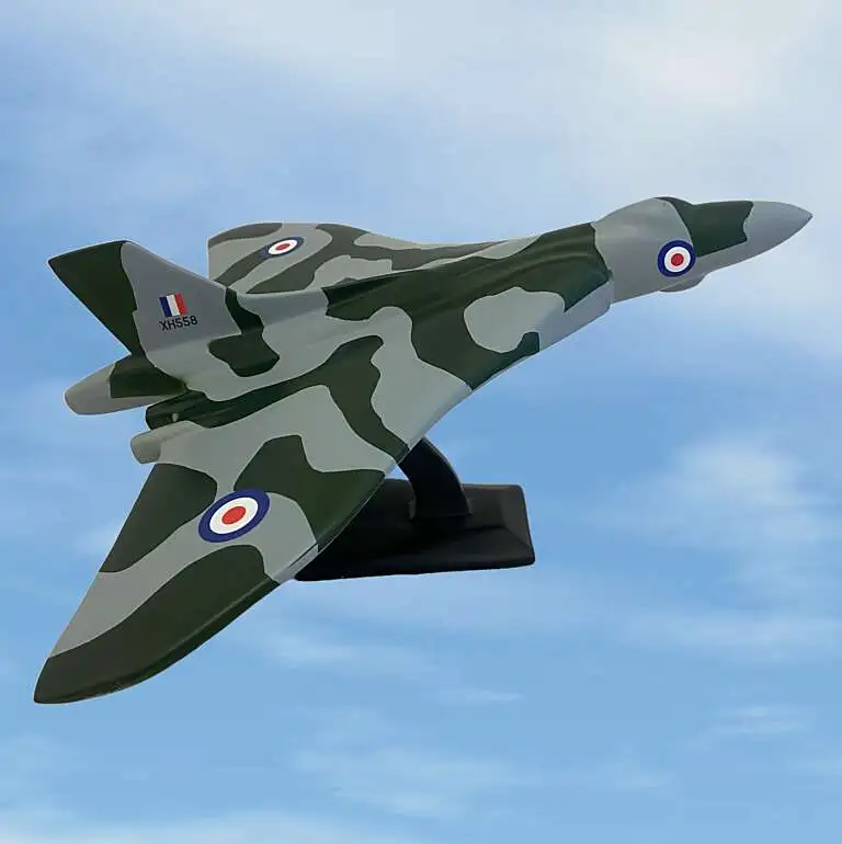
From his memory, he believes he was flying the white aircraft (an Avro Vulcan bomber) for the company photographer. He recalls they flew around south west England looking for just the right combination of cloud and land.
Below the picture is a page from my father’s flying log book dating to around the time that the image was captured. The aircraft in question, XH535, was destroyed in an accident near Andover in May 1964, so we know the picture was taken before then.
One thing that has puzzled me for a while is where the picture was taken? There is a very distinctive inlet just behind the aircraft, however despite studying Google Earth I was never able to locate it.
The answer came via email from a current test pilot at Boscombe, who told me they still fly out that way. I’ll reveal it in a later email, but feel free to test your skills and try and find it on Google maps first.
The accident that befell XH535 was tragic. As was common with Vulcan bombers, the two pilots were able to eject to safety, but the rear crew, all four of them, perished. It was one of the incidents that inspired the story in The Final Flight.
You may remember I have in my possession a wonderful air to air photo of a mighty Avro Vulcan (one of the stars of the novel).

The picture was taken while my father was a test pilot at RAF Boscombe Down in the 1960s. He vaguely recalls hunting about for some cloud as a backdrop but as you can see it was a clear day and they only found the odd wisp.
In terms of location ‘west’ was all he could tell me. However there’s a distinct inlet just behind the aircraft in the photo and I felt sure I could find it on Google Earth. Alas, I never have and I decided to crowd source an answer from you.
I received an email was from Wing Commander Damien Van Carrapiett. Damien is a medical officer at the RAF Centre for Aviation Medicine, not far from me in the UK. While Damien himself didn’t recognise the location, he was kind enough to send it to a current test pilot at Boscombe who he works with.
Hey presto. His colleague immediately recognised it as a regular route out west for the trials teams. Here’s what he wrote:
Have a look at Peterstone Wentlooge, Welsh side halfway between Cardiff and Newport. Just to the east of the golf club is your inlet, now heavily developed.

So the photo was taken high above the Severn Estuary, in 1962. Mystery solved and a little piece of my family history has some further illumination.
Thank you Damien! And thank you for inviting me to visit you and see some of the kit you use, such as the pressure chambers they use to test pilots, some of which date back to my father’s time and the era the novel is set in.


Dr Steve Liddle CEng FRAeS, is a Vulcan to the Sky Trustee and Principal Aerodynamicist at Aston Martin Formula One Team. The articles here are
January 1947 – Clement Attlee’s government had made the decision that Britain required an independent nuclear deterrent to maintain its position in world politics. Arriving
Mr. Alan Ainsworth, was on the Flight Test and development Team of AV Roe – read on for an interesting account of the early days,
Julius Robert Oppenheimer was an American theoretical physicist and is among those who are credited with being the “father of the atomic bomb”. He was